Mui Dinh: dunes, the lighthouse walk and the jeep question
Walk it. The 1904 lighthouse on its 178 m hill is about 1.5 km from the car park across sand and rock, and the lift to the top by jeep, 20,000 to 30,000 VND a trip on a 2026 travel-agency page, is a different product from the 700,000 VND dune tour. There is no entrance ticket, only parking. Go at first light; there is no shade and no water on the walk.
Walk it. From the car park at the end of the Mũi Dinh road it is about 1.5 km across sand and rock, with gentle slopes, to the lighthouse the French built in 1904 on a hill of 178 m, and the walk is the reason to come. There is no entrance ticket; the travel-agency page I rely on, dated June 2026, lists parking at 5,000 to 10,000 VND for a motorbike and 20,000 for a car. A lift to the top in a local jeep was quoted on the same page at 20,000 to 30,000 VND a trip, if the heat or your knees argue for it.
The jeep question is really a confusion of names. That short lift and the 700,000 VND jeep are different products: the second is a 60 to 90 minute tour over the dunes to Bãi Tràng beach with sandboarding, sold by the operators at the dunes. Ask exactly what you are buying. And whichever you choose, go at first light, because there is no shade and no water on the cape.
How do you get to Mui Dinh?
Mui Dinh is the boulder-and-dune cape about 40 km south of Phan Rang. The route the travel agency describes is QL1 south towards Cà Ná, then the Mui Dinh road for about 7 km to the car park in Phước Dinh commune. Ordinary cars stop there; the final stretch is soft sand and rock. DT701, the southern coast road, also reaches the area from Sơn Hải fishing village to the north and runs about 51 km in all from Ca Na through Son Hai and Bình Sơn to Ninh Chử. I ride DT701 down from Ninh Chu and QL1 back, which gives the dunes at Nam Cương on the way out and Ca Na’s salt on the way home.
From Nha Trang it is 95 km to Phan Rang and then the 40 km on, so this is a night away rather than a day trip, and Ninh Chu is the base. DT701’s northern twin is in the Nui Chua coast road, and the two make a pair of days from the same bed.
What is at the top?
A working lighthouse and a view of a coast that looks like the edge of somewhere much drier than Vietnam. The French set up an observation station on the cape in 1899, because it was a hazard to shipping, and built the light in 1904. Vietnamese Wikipedia gives a 16 m tower on a 178 m hill with a range of 30 nautical miles; a 2026 travel site says about 18 m and about 176 m, and I go with Wikipedia. In February 1945 several Japanese vessels were sunk off the cape. I found no published visiting hours for the tower itself and I have not been inside; the walk ends at the compound and the view, which is enough.
The view is the point: dunes running down to the sea on one side, boulder fields the size of a village on the other, and the light on its hill between them.
Walk or jeep?
Option
Price on the 2026 lists
What you get
Source
Walk from the car park
Parking only: 5,000 to 10,000 VND a motorbike, 20,000 a car
About 1.5 km each way across sand and rock; the better part of an hour up for me, in the cool
intour.com.vn
Short jeep up to the light
20,000 to 30,000 VND a trip
The lift over the sand to the top
intour.com.vn
Dune jeep tour, whole vehicle
700,000 VND a jeep return, 900,000 for the full-terrain version, up to 6 passengers
60 to 90 minutes over the yellow and white dunes to Bai Trang beach, sandboarding included
hellophanrang.com, the operator’s own list
Dune jeep tour, per person
555,000 VND in groups of 4 to 6, 515,000 in groups of 7 or more
The same tour, shared
hellophanrang.com
Tour with a seafood meal
950,000 VND a person for 2 to 3 people, 780,000 for 4 to 5, 680,000 for 6 or more
Tour plus lunch
hellophanrang.com
I walk, every time, and I am not against the jeeps: the dune tour reaches sand my legs will not, and with children or in the heat the 20,000 VND lift is sensible. What I would not do is pay for the big tour thinking it was the lift, which is the mistake the naming invites.
What about the dunes and the beach?
Two dune fields, the yellow and the white, run down from the cape towards Bai Trang, the beach the jeep tours stop at. On foot you can wander onto the near edge of them from the walk and get the picture without the tour; the far side and the beach are a long way over soft sand, and I would only do it at dawn with water. I have walked down to the beach once, early, and had it to myself. It is exposed and unpatrolled, and I did not swim. For a beach to swim at in this corner of the province, my beach ranking sends you back to Ninh Chu.
Kites are the other thing the wind does here. The season and the schools are in kitesurfing season in Phan Rang, and the same north-wind months that fill the kites keep the dune ridges moving.
Is Nam Cuong the easier option?
Yes, and for most people the better one. The Nam Cuong dunes lie at An Hải, in the former Ninh Phước district, on the coastal road south of Phan Rang before you reach the Mui Dinh turn. There is no walk in, no jeep and no fee that I could find; there are also no facilities, no shade and no water. The dune field shifts with the wind, so the ridges are never the same twice, and it is far less visited and far less sold than Mũi Né down the coast. Sunrise or the late afternoon, an hour or two, and out before the sand becomes unwalkable between about 09:00 and 16:00.
Field note: at Nam Cuong I have twice met goats before I met people. The herders cross the dunes with the flocks in the early morning, and the sheep and goat country starts right here.
The dishes those flocks feed are in the dry-country food post, which is the evening after either dune.
When, and how hot?
This is the driest corner of Vietnam. The Phan Rang station’s normals give 838.5 mm of rain a year and 3,029 hours of sun, with monthly mean temperatures from 25.1 C in January to 29.3 C in May, and English Wikipedia notes that parts of the old province get under 800 mm. January to August is the dry season and the sensible window; in the rains, from about September to December, the sand is easier underfoot but the cape is grey and the sea is up. Whatever the month, be on the sand by first light or after four, carry more water than you think you need, and cover up, because the sand reflects.
What I’d do
Sleep at Ninh Chu. Leave before dawn on DT701 and take Nam Cuong at sunrise on the way.
Mui Dinh car park while the light is still soft: pay the parking, walk the 1.5 km to the lighthouse, sit at the top.
Down by mid-morning. Buy the dune tour only if you want the far dunes and the beach and the day is not already hot.
Ca Na for the salt pans and a look at the beach, then QL1 north to Phan Rang for goat or lamb.
Skip the whole thing between about 09:00 and 16:00 in any month; it is not a midday place.
If you have one morning for sand in this province, Nam Cuong at sunrise is the easy answer. Mui Dinh is for the day you have the legs and the water for it.
Questions I get asked
How far is the walk to Mui Dinh lighthouse?
About 1.5 km from the car park across sand and rock with gentle slopes, by the travel-agency page I use, up to the light on its 178 m hill. It took me the better part of an hour in the cool of the morning; it would be miserable at midday.
Is there an entrance fee for Mui Dinh?
No ticket, by the travel-agency page dated June 2026. You pay for parking, 5,000 to 10,000 VND for a motorbike and 20,000 for a car, and separately for any jeep or ATV you take.
How much is the jeep at Mui Dinh?
Two things are called the jeep. A short lift from the car park up to the light was 20,000 to 30,000 VND a trip in 2026. The dune tour, 60 to 90 minutes over the dunes to Bai Trang beach with sandboarding, was 700,000 VND a jeep of up to six on the operator's 2026 list.
Is Nam Cuong easier than Mui Dinh?
Yes. The Nam Cuong dunes at An Hai are on the coastal road south of Phan Rang, closer to town, with no walk in, no fee I could find and no jeeps. There are also no facilities, no shade and no water; go at sunrise or in the late afternoon.
Can you drive a car to Mui Dinh lighthouse?
Only to the car park. The final stretch is soft sand and rock that ordinary cars cannot cross; from there you walk about 1.5 km or take the local jeep up.
Sources
Read on 15 September 2026. Prices, hours and rules change; these are the pages the figures came from.
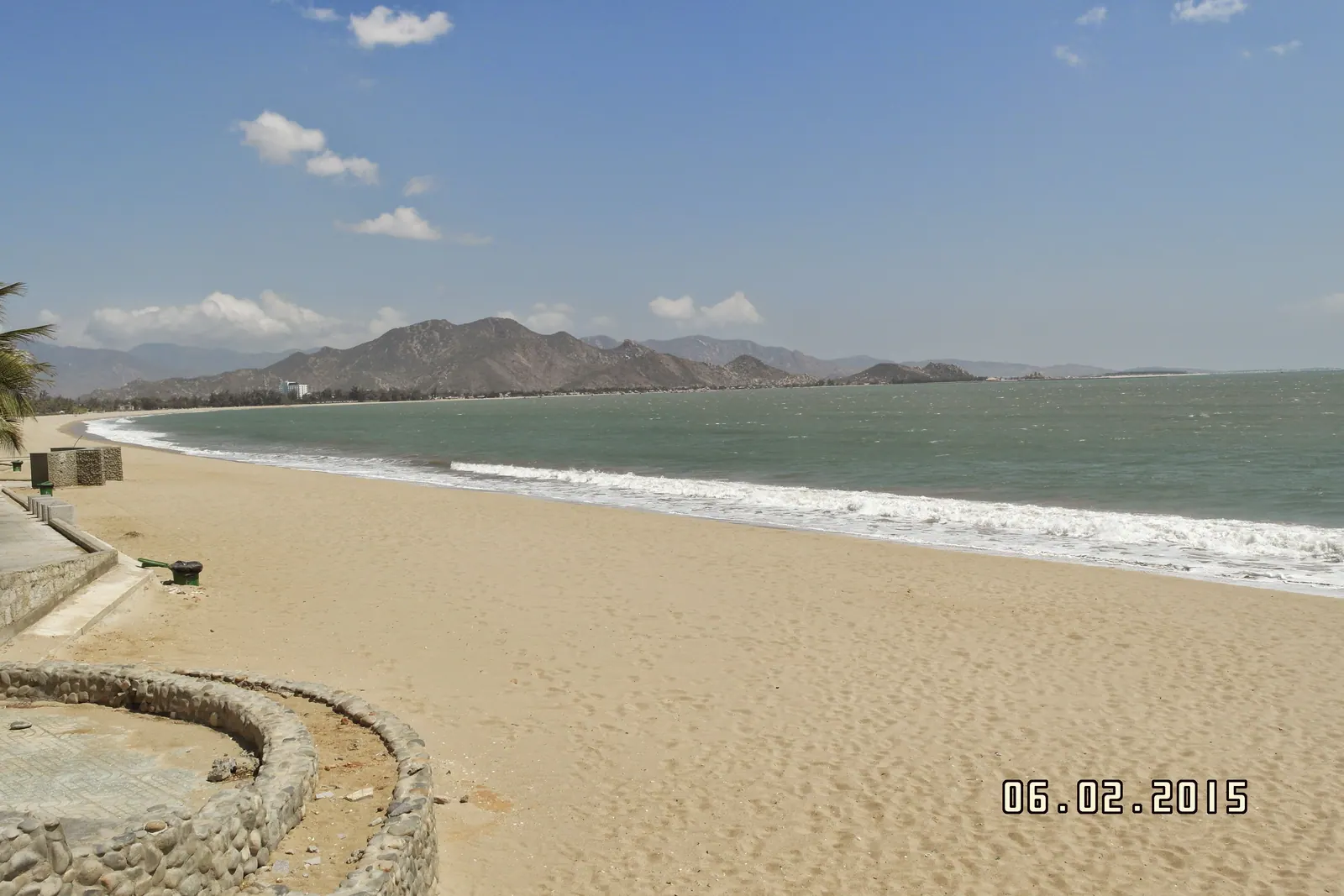
The season is the north-east monsoon, roughly November to March, with the strongest and steadiest wind in December and January. My Hoa, a flat beach over 4 km long on DT702 north of Ninh Chu, is the established spot, with four kite centres counted there in 2019. No My Hoa lesson price is published anywhere I could find.
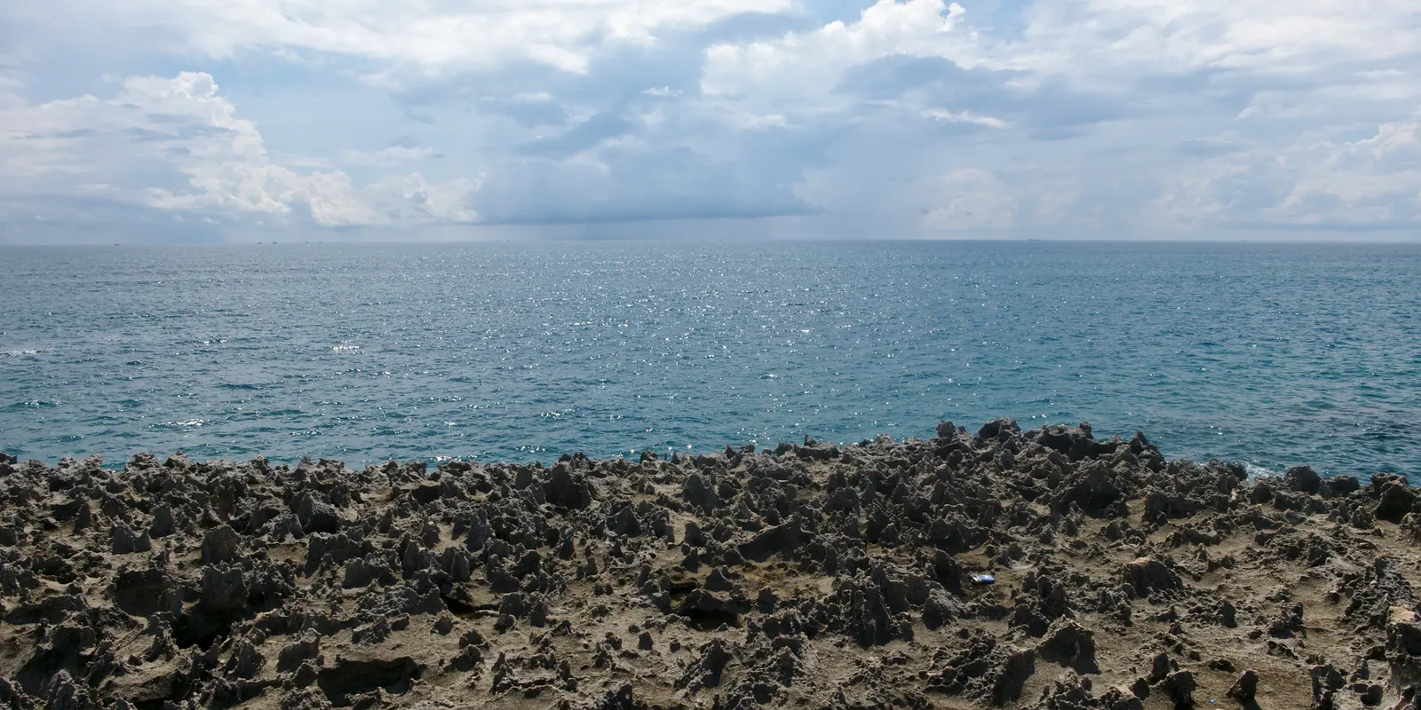
Hang Rai is a raised shelf of fossil coral on the DT702 coast road, run as the visitor site of Nui Chua National Park, and it is not for swimming. Go at first light on a falling tide for the water sheeting off the terraces, and between December and March for the green moss. I never found an official fee; travel sites quote 30,000 to 35,000 VND.
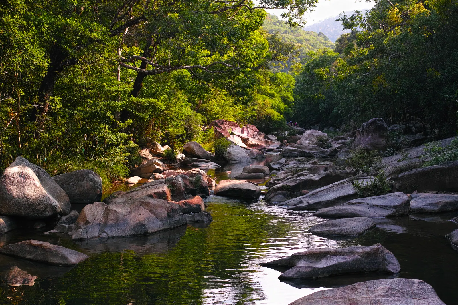
Ba Ho is three pools on a forest stream 25 km north of Nha Trang, reached by about a kilometre of boulder scrambling. From January to May the water is clear and the granite is dry enough to trust; from October to December the same rocks are wet and the stream can flood. The official adult ticket was 135,000 VND in September 2026.
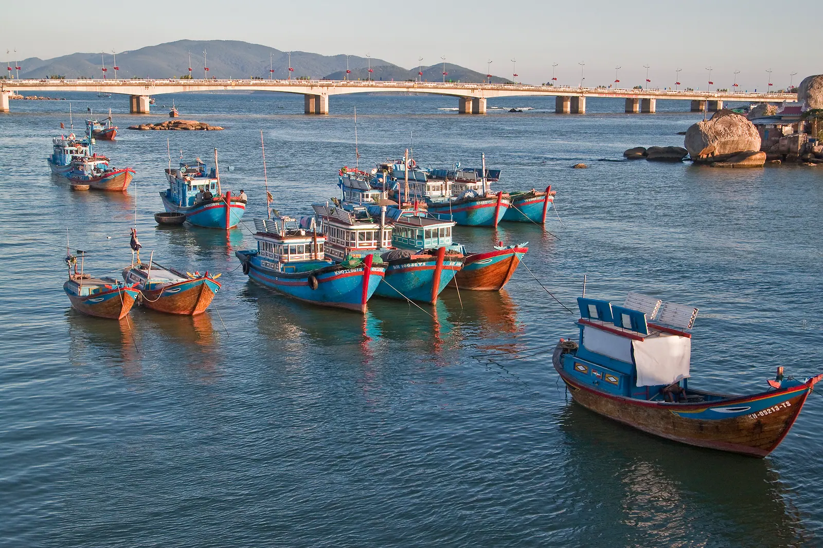
The Cai river runs 84 km from its source on Hon Gia Le at 1,812 m to the sea at Cua Lon in Nha Trang. Followed upstream by motorbike it is the fishing fleet and three bridges in the first stretch, the rice of Dien Khanh in the second and the hills of Khanh Vinh in the third, 30 to 35 km by road. I turn back at Khanh Vinh town, where the road climbs the pass.